Saturday, December 26, 2015

SW 2015 Travelogue


Adrift in the Southwest; December 2015

Cascadia

Amid a wild, melancholy illness brought by the acute gloom of Novembers in our fair Cascadia, I sought cure in the Desert Southwest.
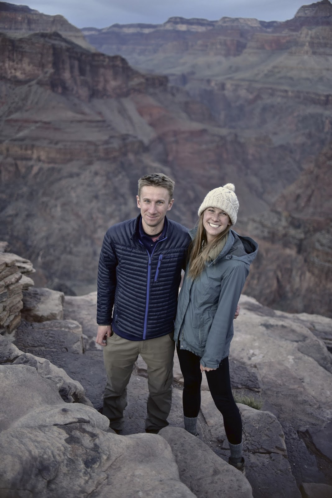
Randi, a friend of mine from my AmeriCorps days, had invited me to fly down to Arizona for a visit sometime around Thanksgiving.  As an afterthought, almost, she mentioned hiking the Grand Canyon.  The reason being was that I’d been bellyaching with greater than normal frequency at how down I’d felt because of the weather, and Randi (oh praises to her sweetness), who I guessed was holding a certain degree of pity towards yours truly had offered to assist with transportation and lodging.  With mileage points piled up, and a string of other petit fortunes striking, including the work approval to take a week off, and the granting of permit to camp beneath the canyons, I found myself on a plane.  A family of four humans (two little ones) + 1 dog + varying population of hens living outside of Prescott, two hours north of Phoenix, Randi’s modest abode had in some ways been the subject of envy at my end.  Their home housed plenty of musical instruments, decors that implied a fondness for the outdoors, Kayaks and Canoes laid erect like a Rodin out on the front yard, and a collection of whiskey stowed away in the garage.  Who wouldn’t be envious?

Hens

Randi, Ross, and the kids picked me up at the shuttle office in Prescott.  It was Sunday at 1730h, and we planned to dine with several friends at the Prescott Brewery.  The weather was cold, almost similar to Washington State.  However, I noticed that the famed Arizona sunset had painted the sky a deep metallic blue and vivid streaks of crimson flurrying like tendrils reaching out into the darkness of night.  
“I haven’t seen the sun in two weeks.”  I told no one in particular.  I still haven’t given that I slept the entire way down, but the sun’s traces were there.
The next morning, a blue sky was evident in the horizon, with several glasses of whiskey imbibed the night before, I languorously readied for the two hour drive and 8 mile hike down on the South Kaibab Trail.  Randi's Jeep, which I would refer to here as the Diskins' Jeep (pardon the synecdoche, but I aim for inclusivity), would be my primary mode of transportation through the interstate for the week, and my feet, of course, over the trails.  
    Five years ago, this path was the inaugural backpacking trip down the Grand Canyon that also launched my fondness for traveling on foot.  A loop trail that can be journeyed any number of ways.  Unlike last time, my voyage would complete the orbit counter-clockwise.

Atop South Kaibab Trail

I arrived at the South Rim Visitor Center shortly past 1430h and I immediately caught the shuttle en route to the trailhead.  It was balmy, which felt strange because the thermometer suggested that the temps were, in fact, somewhere along 46˚f - fairly cold in my book.  I lifted my pack, and checked that the ukulele was still in tune, which it was.  With everything in proper order, I proceeded to the trek for Phantom Ranch down on the Colorado River.  
On the journey, I didn’t need to exert a whole lot of energy descending, however, my knees felt stressed due to the steepness of the decline, and I couldn’t walk faster than I did.  At sundown, the campgrounds were still two miles off and realized I would be hiking in the dark.  As I furthered my way into the trail, a family of bighorns jumped out to cross in front and I was sufficiently freaked out.  
“Goddamn animals.”  I shouted.

Zoroaster Temple Seen Along South Kaibab; 3 Miles from Camp

The campgrounds were located on the north side of the Grand Canyon, separated from the trail by the Colorado River, and bridged together by, well, a bridge.  When I arrived at the crossing, stars were twinkling aloft, and a faint glow of reddish gold still shimmering across the spire of Zoroaster Temple high above.  I set camp, cooked dinner, and breathed the air before realizing that it had gotten very cold; my Suunto sensed 38˚f, this was 1930h.  The campsite was spacious and adjacent to the roaring Bright Angel Creek which bothered my sleep - I always preferred sleeping in/near silence.  After several hours of trying to convince my brain that it was tired and should really do the Zzz’s, sunlight had began seeping in, lighting up my tent with rapid intensity; this was 6ish.  I rose, more tired than last night.  When I crawled out of the tent, several backpackers were making their way to the Ranch, a quick two minute walk, and I felt inclined to do the same.  When I arrived, I bought postcards, wrote to several friends, and mailed them: The cards would be couriered by a mule up to the South Rim sometime later.  

1st Camp

Phantom Ranch was slightly different from my memory of it 5 years ago. There were buildings I couldn't recall from last time, and a new trail across the creek had been constructed.  Also, I wasn’t sure whether the area smelled of mule droppings from when I was there last, perhaps it did and I just forgot, but it struck and to gain solitude from the thing was a task that required a little effort.  I exhaled and made my way back to camp.

Bright Angel Creek

Phantom Ranch

While sauntering along, I relished the sight of yellow foliage shielding the soil from a glinting sun.  I noticed that several colonies of prickly pear as green as emeralds were strewn near the Bright Angel Creek, and many agave plants spiraled like miniature galaxies had lined the rock walls.  The sky was deep blue, and the air was cool, I made lunch and packed my things.  It was Tuesday, and there were five miles that needed hiking up the Bright Angel Trail toward Indian Gardens where my next campsite would be.  
The Bright Angel Trail was mostly a gentle stroll.  But as I furthered the distance and the day’s heat growing more oppressively, the walk began to feel taxing.  I passed a pair of hikers on the trail, who later passed me, and whom I would again pass somewhere along; we were playing a mildly cruel and subconscious form of tag.  In the brief moments when dialogues were exchanged, I discovered that they, too, were headed for Indian Gardens.  
When I arrived, there was one other backpacker who was fully settled in and appeared to be looking for ways to kill time.
“Good afternoon, it looks like it’ll just be you and me here.”  He said.  The place was large and had plenty of good space.
“For now, there’s a couple more coming.”  I replied.
His name was Mark.  A 50-some year old resident of Phoenix who pronounced “Tonto” as “Tanoe.”  
As in:
"I took the Tanoe Trail to get here.”  Which drove me to realize that he wasn’t at the standard route upon Bright Angel today.  
    "That's pretty rad."  I thought out loud.  

Mark Facing North at Plateau Point

We had a nice chat on the joys of hiking solo before I proceeded to find my own campsite.  The sun was still high, but the winds were noticeably cooler than at the bottom of the canyon.  The trees were greener there, and the grass was a lot taller, too.  Songbirds were abundant, and herds of deer were grazing on and off the campgrounds.  The two hikers I was lapping had arrived, and they chose to camp further uphill, closer to the bathrooms.  
“Tag, you’re it.”  I said, and they laughed.
I pitched my tent upon a patch flooded by sunlight.  With last night’s burdensome sleeplessness, I immediately laid inside for a nice warm nap and when I woke, it was already late afternoon.  I made tea and began to prepare dinner.  
Mark came over for a visit and told me stories of his adventures to which I eagerly listened. Almost instantaneously, the two hikers came down to say “hi.”  A brother and sister, Daniel and Theresa, one living in Baltimore and the other, Boulder, respectively.  Theresa was drinking wine out of a clear platypus bottle and I eyed it with gusto.
“Care for some?”  She asked.  Mark refused, but I did not hesitate on the offer.
“Are y’all planning to watch the sunset at Plateau Point later?”  I asked, wine swishing in my coffee cup.

Theresa on Plateau Point

The siblings were ostensibly unaware of the place existing nearby, and Mark vouched that it was, indeed, a great area to watch the setting sun.  Soon later, we found ourselves marching on the way there.


Plateau Point Trail

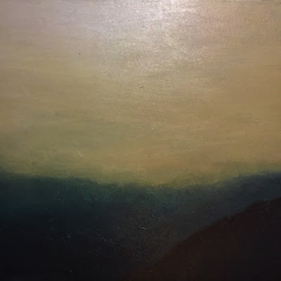
When we arrived, a soft Alpenglow had painted the canyon walls.  The darkened corners were shapes that seemed like downturned pieces of a jigsaw puzzle.  The sky was vast, and the river below looked of pale silver.  With no one else around, Plateau Point seemed as if it was placed there by the powers that be exclusively for the four of us.  As I watched the sun set, I felt awe and thought that the magnificence I was beholding was surely reserved only for those residing in paradise.  We sat and gawked at the breathtaking canyons for about a half-hour.  When we left on our way back to camp, a mile/mile and a half away, several stars had perforated the darkening sky.  

Daniel and Theresa

Colorado River 1500 Feet Below

Sunset On the Canyons

Indian Gardens was colder overnight than down at Phantom Ranch by, at least, 10 degrees.  But I slept wonderfully.  When I woke, some areas were covered in frost and the ground was hard as a rock.
The following day was again clear and sunny.  However, the air persisted upon its frigid nature and I felt compelled to brew several cups of coffee when usually one would've been sufficient   Mark came over to announce that he was readying to leave for the trail and 15 minutes later, he was off on his way up the rim.  I gulped the rest of my coffee, vapor emanating from my nose, and prepared to pack my things.  
“Maybe I can catch up with him on the way.”  I thought.  
It didn’t take long to pack.  Roughly 10 minutes since Mark left, I, too, was off to the trail.  The siblings were already gone when I passed by their site - the time was 1100h.  This was the final leg of my time here on the Grand Canyon and it felt forlorn; I didn’t want to march back and herald my return into the sinking sadness that was my life.  Actually, my life really wasn’t sad at all; the dreary conditions in Washington State often made it seem as if it was.
“There are far greater types of suffering around the world.”  I reminded myself.
A little more than a mile later, I caught up with Mark.  We lauded the idea of hiking alone the day before, but it felt nice to have someone along for the journey this time.  

Grandview Point

Epilogue:
I got back to the Diskins' Jeep at about 1500h and drove east to a hotel in Page, Az.  The next day, I visited Horseshoe Bend and the slot canyons.  I scored a solo tour of Lower Antelope Canyon, which was, for a lack of a better word, magical.  I urge you, dear reader, to go and explore it for yourself.  You couldn’t possibly regret it.  
That afternoon, I drove two hours to Utah where I breathed the crisp air eddying across Monument Valley.  I stood in front of the towering mesas shaped like animals, mittens, or sisters.  I took my ukulele and strummed to the tune of bruddah Iz's "Somewhere Over the Rainbow."

Horseshoe Bend

Inside Lower Antelope Canyon

Yours Truly Exiting Antelope Canyon

Utah/Arizona State Line

The Diskins' Jeep

Monument Valley

Three Sisters on the Left

Sunday, November 8, 2015

Thursday, September 10, 2015

Wonderland Trail Essay

Trail Dreams
A week spent on the Wonderland Trail.

Day 1:
Wednesday morning, 7 a.m.  The sun bursted into the window, illuminating every corner slowly and imperceptibly.  With an exultant air, I headed to the kitchen for coffee.  My ride, a friend named Steve, wouldn’t arrive until close to noon, and this was an opportunity to scrutinize the state of my pack.  Initially, my intention was to keep the weight under 25 lbs., except, with my stubborn drive to ensure that I be encased in as much luxury as possible, the pack had clocked in at 35 lbs.  
“Crap, dude.”  
The Wonderland Trail is 93 or so miles long and 22,000 or so feet high.  With a pack weighing nearly a third of my body weight, it would appear that I intended to hike myself into self-destruction.  That wasn’t the case.  I planned to enjoy this trip as much as possible and not forgetting that was the goal, I knew that meant jettisoning things that weren’t truly essential.  
The things that went were; an ENO hammock; extra shoes; batteries; a flask of whiskey; and then my D-SLR camera [Phone would suffice, I thought. (This was hard)].  I placed the backpack upon the scale, and the diet it had just been in shaved its weight down to 26 lbs.  As I was siphoning off a mostly empty cup that had served me 4 cycles of coffee, the phone had rang and Steve was headed over to pick me up.

Summerland. 
This hike was a nice gentle stroll.  So much of the path was under the shade, and the glacier flavored summer wind which blew softly against my forehead enabled me to move andantino.  Steve and Rehan joined me on this part which afforded us the prized group shelter.  The day had been glorious, permitting enough time for a little rest and relaxation. The night was pleasant; tranquil and cool, and I slept like a babe. Had this near-perfect premier establish the structure for all of my ambling upon the Wonderland Trail, then the following six days would breeze on by.  Unfortunately, the ensuing days would prove this otherwise.


Day 2: Maple Creek Camp.
Steve woke up early to greet the sunrise.  Summerland was one of the few areas on Mt. Rainier National Park that was known to enjoy the first kisses of the morning sun.  I unzipped my tent and was catching the final stretches that transitioned morning into the height of day.  The area was bathed with an orange hue, and the dew that evaporated from the meadows released the scent of honey so manifestly pure you could almost taste it.  I packed my things and by 9:30 a.m., I was off to the trail.  
The hike, for the most part, was easygoing because the trail on the eastern bounds of Mt. Rainier was very well groomed.  The sky was clear, the air was warm, there were plenty of towering Douglas Firs available for respite against the mellow heat, and so much of this leg was downhill crossing Panhandle Gap, Ohanapecosh Park, Indian Bar, Cowlitz Divide, and Box Canyon; all listed in their respective order.  There was an abundance of panorama and spectacular glimpses of Mt. Rainier on this section.  At some point, the breathtaking views began to feel so commonplace that I eschewed lifting my head to scan for sights.  With summer’s awesome glory, the day’s 14.5 mile duration was something I could easily describe as literally, “a walk in the park.”
I passed several hikers near the road crossings on Box Canyon, many of them remarked on the forecasted nasty weather which was expected to strike come Saturday.  One of them, with a vague sinister look, had pointed at the clouds aloft as harbinger that, in fact, the rain would begin to fall tomorrow, which would be Friday.


Day 3: Resupply at Longmire, and Devil’s Dream Camp.
It started raining around 3 a.m. this morning.  That other hiker was right, the rain would come today, and not Saturday.  Strangely, the many signs of summer so evident and blooming in the landscape the day before had been erased overnight.  The air was damp, the clouds hung low, and the temperatures refused to rise past mid-50s.  
I left Maple Creek Camp early at 7:30.  Friday would be one of the longest hikes for me on this journey with its 20ish mile distance, and 4,800 ft of climbing.  With the oppressive dark clouds subduing the light of day, the gentle rain would only grow vengeful in due course.  I labored to reach camp before evening because, for some reason, I felt that the heavy storm would wait until 7ish p.m., after I had secured myself tightly within my sleeping bag inside my tent.  Which, luckily, was indeed the case.  
The first few sections on Stevens Canyon on my way to Longmire had been uneventful.  I didn’t see a whole lot, although the nearby foothills have had clouds brush up against their trees which looked enchanting.  I saw them as real life versions of the landscapes seen in Chinese Scroll Art.  
The Wonderland Trail passed through the famous and usually bustling area, Reflection Lakes.  I arrived there at 9, a car was parked and it was ostensibly pulling out of the lot and back on to the road.  Rain had stopped for a little while, but the sun wasn’t seen anywhere.  I walked further and found a spot for breakfast where I pondered the serenity of the place.  It wouldn’t be dishonest to claim that I was the only person in the area and it felt nice because it looked like paradise, and it was there only for me.  With a bag of granola and a hot cup of coffee in hand, I saw a doe with its young, across the lake, approach the shore for a drink.  
“Holy smokes, this is straight out of a Bierstadt painting” I thought. 
I arrived at Longmire early afternoon to pick up resupply which added extra 12 pounds to my pack.  I wasn’t too bothered by the weight, since so much of Friday’s distance was already behind, and with less than 6 miles to Devil’s Dream Camp, I figured the rest should be all right.  Those 6 miles, however, were crushingly hilly and at the end of day, I felt as if my shoulders underwent a demolition attempt.  After passing a few dry creek beds, I was a tenth of a mile away from Devil’s Dream, and it seemed I only had to walk a little further to get there.  Unfortunately, the campgrounds just wouldn’t come. With water in my Nalgene almost gone, and still climbing uphill, my pack began slouching down to my left shoulder, exerting a greater heft.  I was exhausted and decided to pull over to the side of the trail for inspection.  I saw that abrasions had formed.  
“This sucks!”
I re-entered the trail and after a few minutes, at long last, I set foot on Devil’s Dream Camp.  When I saw the first campsite, my legs refused to move.
“Campsite 1 it is.” I murmured.  
My Nalgene bottle was now running empty.  I dropped my pack and searched around for a nearby source.  Nothing.  There were tents in many of the other campsites but their occupants were away it seemed.  Not a single human to ask for water related intel.  Actually, I did see a girl next to my area but she was reading a book, and I’d hate to bother anyone out of that.  
“I guess I’ll set camp and then worry about water later.”  I murmured realizing I’ve been murmuring to myself all day.  
On my way back, a hiker surveying the privy outhouse introduced herself.
“Do you know where I can find water?” I asked.
“Oh, this is a dry camp.  My friend and I got water two miles downhill.  We heard about the water condition at Longmire.”
No one at Longmire had been so generous as to pause for a short time to relay me the small, yet critical memo concerning the dry water status at Devil’s Dream Camp.
“Just my luck.”  I whispered.
“Well, what you can do is hike a mile or so uphill and there should be water there.  At least you’ll be heading down instead of up on the way back.”  
Jenna, her name, was absolutely right.  And even though I felt resentful, there really was no other way around it.  This was a card that trail life had dealt, and I needed to play as fairly as I could.  I pitched my tent, hung my wet socks on a line, and then re-entered the trail.  To an extent, this was a blessing.  With the absence of my backpack I was able to appreciate, with discerning focus, the meadowlands that served as gateway to Indian Henry’s Hunting Ground.  There, I found a running creek.
The girl who was reading a book at the adjacent campsite was Jenna’s friend, Cora.  I chatted with them for awhile.  Jenna and Cora were the closest of all human contacts, apart from Steve and Rehan, I’ve encountered in the 3 days I spent on the Wonderland Trail, thus far, and evidently, ever.  The Wonderland is quite popular, and there were plenty of day hikers, but most of them I met with only passing glances, and memories of them go fleeting like the autumn leaves that fly in the air.  
“Yeah, we’re here on vacation.  I work in IT for an office in downtown Seattle, which is one of the the reasons I go backpacking.”  Jenna said.
Cora was visiting from Minnesota, and was ostensibly out here enjoying the Pacific Northwest in the most Pacific Northwest way possible.  Although, with the knowledge of the forthcoming storm, there was an air of dispiriting concern, and the three of us were enveloped by it.


Day 4: North Puyallup River Camp.
It had been a mostly peaceful night.  Rain came and went, but it didn’t pelt as badly as I expected.  It bore the rhythm similar to the leisurely pace that my feet had been in over the course of this journey.  
I peered outside of my tent window and saw that water was pooling nearby and inching closer into the vestibule.  Today’s hike to North Puyallup River would be one of the shortest, ergo easy, so I figured there was no need to rush.  Boy, was I wrong.
I started packing at nearly the same time Jenna and Cora were.  They, too, were headed for North Puyallup River Camp.
“I should pay closer attention to depressions next time.”  Jenna said, quickly pulling the stakes off her tent, attempting to salvage the rainfly away from further infusions of moisture.  The surface upon which their tent had been standing became a basin, a nightmare sight for any backpacker.  
From the get-go, the hike was, unsurprisingly, hilly.  It traversed Indian Henry’s Hunting Ground (some of which I had already seen the day before).  I saw the eerie undulations of the low-lying clouds brush against the peaks of Copper and Iron Mountains, and I gasped at the powerful sight of the scintillating light that reflected off the two Tahoma glaciers.  Wind was picking up, and it insisted in blowing the cap off of my head. 
On this section, the almost-mythical Tahoma Creek Suspension Bridge would appear.  My experience at crossing it was terrifying even in spite of its relatively short span.  The crossing was through a wind tunnel, and the bridge was predisposed to oscillation.  With no alternate option, I was choice-less and knew that the only way to move forward was to put up with a little trembling and vertigo.  Here, the wind had forced the rain to stop falling downward, and instead brushed from side to side like a comb. 
“Just do it" thought I.  And it, I did.  
It only got worse from there.  The trail had already been hilly to begin with, but after TCSB the trail became steep.  
A hilly trail, in numerous ways, is different from a steep trail.  
Whereas one could straggle onward and still preserve a smile upon a hilly trail, one would belabor the idea of convincing one’s self that coming out alive off a steep trail was at all possible.  This was the heartbreaking reality that burdened all Wonderland hikers upon TCSB’s ensuing 3 miles.  But off I went, and climbed what felt to be an endless onslaught of pain and suffering. 
The 3 heartbreaking miles were dealt, and upon its end, I desperately hoped for the trail to bestow mercy since I had just surmounted what felt to be the most astonishingly difficult thing I, or anyone, had ever done in all of history, ever.  
Fat chance, because in came Emerald Ridge.  
Emerald Ridge is a modest-sized plateau that borders Tahoma glacier on its northern terminus and something else on the other.  The trail traces its edge, and I mean literally, its edge.  On one side is a berm, and the other, a cliff drop down a sprawling moraine, the thunderous sound of South Puyallup River screaming 1,200 feet below, like a chorus of a million dead souls.  
How spooky was it that I camped at a place known as Devil’s Dream the night before?
The wind had picked up even more intensely, and as I climbed higher up to Emerald Ridge, the orange rain cover which had, for awhile, been securely wrapped over my pack was now flying and I looked like a monarch butterfly with the other wing cut off.  The bottom tether kept it in place.  As I tried to inch forward, the wind picked up some more.  It blew against my side, and it forced me to a crawl on several occasions.  The most notable thing, and by notable I mean scary, was that the pack would become sail.  The wind blowing into the direction of the moraine meant it was not only possible for clear-headed hikers to fall into the South Puyallup River, but the trail was maybe designed for that to actually happen, especially amid a squall.   
A short distance behind me, gale force winds in full blast, I noticed someone was sitting atop a boulder.  I saw red tank top and a blue hardhat, but her (I concluded this was a woman) face was indiscernible.  As I hiked farther away, I kept turning to look, making sure this mystifying and surreal presence was an illusion which my mind had fabricated after I emerged from one of the most spectacular terrors I've yet to face during this hike.  But there, she continued to exist.
At 4 p.m., I arrived at North Puyallup River Camp.  I deduced that, although it was one of the shortest, day 4 on the Wonderland had been the most difficult.  After my tent was set up, in spite of the voracious hunger I’ve been tolerating for hours, I passed out.  
A short while later, Jenna and Cora had arrived.  Being the first one there, I chose the nicest (and nearest) spot forgetting another group would arrive and might want the space for themselves.  I offered to share my campsite but learning from yesterday’s watery mess Cora pointed at the depression, which was basically the entire half of the area, and decided that setting camp at the adjacent site would be best; the rain would only intensify overnight.  The nearby North Puyallup River thundered on, but on numerous occasions the rain fell with tremendous ferocity that the sound of the river was silent in comparison.


Day 5: Eagle’s Roost Camp.
“Did you notice that the rain was nonstop last night?”  I asked the next morning.
“Yeah.  We thought that, too.”  Said Cora.
It was still raining until later that morning.  Jenna, Cora, and I decided to hike together - for the first couple of miles, at least.  They were headed to Golden Lakes, which was 5 miles away, and I to Eagle’s Roost, 17 miles off.  
“Most of what we have is wet, so if the weather keeps holding up like this, we’ll exit out of Mowich tomorrow.”  Jenna said and I was feeling inclined to do the same.  I would be passing by Mowich today, and it would be very tempting to throw in the towel, especially since I began to long for all the comforts of civilization. 
As the trail began climbing again after a short downhill section from North Puyallup River Camp, Jenna suggested that I hike ahead of them given the brisk pace I was traveling with.  
“I’ll wait for you at Golden Lakes.”  I told them.
I met a ranger who was fixing drainage problems on the trail.  So much of the tread was covered in water and it felt like a type of blessing to see him there.  
“Can I see your permit?” He said.
“Uh, it’s on the side of my pack next to the water bottle.”
“Can you take it out?”  He ordered.  I didn’t so much mind the inquiry but I was mildly in pain and would really like to keep the pack secured the way it was because I knew that if I took it out, the fit wouldn’t be quite the same.
“Do you know if the weather will get better tonight?”  I said hoping to strike up some kind of human connection.  
The ranger stared blankly, shaking his head side to side as if to say “don't bother asking about the weather.”  
The ranger’s tacit response deflated me almost immediately.  I continued on and shortly afterwards, I arrived at Golden Lakes, panicking internally and shivering like a cat.  I sat on a chair outside the Patrol Cabin to rest a bit.  A little while later, still panic-stricken I decided to keep walking and head for Eagle’s Roost Camp.  I would only get cold the longer I sit there.  
My head, in its terribly disheveled state had not thought to leave Jenna and Cora a note.  A trail no-no if you’re with a group, but it hadn’t been so bad; no ensuing disasters followed.  
The south Mowich River had two foot bridges that were washed out.  I learned this from a couple of hikers who were traveling opposite I was.  
“If you don’t mind getting your feet wet, you’d have to walk on the river itself.”  Said one.
“Yeah, or really, you don’t have any choice.”  Said the other.  
“My feet had been wet since Friday morning.” I retorted.
Sure enough, the wash outs were there.  When I arrived, a group of 4 backpackers had been trying to cross.  One of them already made it to the other side of the first wash out, and another was hurling all 4 packs over the river.  The other two were finding ways to jump on to cross over several downed logs, far off from the trail.  
“Do you think you’d want to cross that?”  Said the one who was hurling the packs.
“Yeah, I got nothing else to lose.” I joked.
“Except your life.”  He not-joked.
I smiled, and said nothing.
Cross, I went.  The river was silty, and it rushed with evident force.  My trekking poles kept me balanced and I was able to make it to the other side without incident.  The second wash out was shorter, but deeper and it ran a stronger current.  It took awhile, but amid this, the sun began to break, and I was re-energized.  Crossing was successful, easy almost.  I waved at the group and shouted, “Y’ALL COULD DO THIS EASY.”  
I sat on a rock, took a short breather, and wrote in my notepad.
“…felt sad that my trip is almost done.”  Clouds were all around, but the sun shone down on the tiny patch of land where I sat.
When I neared Mowich, I decided to forego the exit and finish the whole hike.  The trail, in spite of its cruelty and the weather’s constant infusion of misery, was becoming my beloved.  It had done nothing less than to test my limits internally and externally.  Amid this, I responded to each of those challenges, and I was elated with the thought of triumph.  What’s two more days?
Eagle’s Roost was devoid of other campers.  I heard this was a popular campsite and surmised that many hikers who planned to be here had exited off at Mowich.  It rained some more overnight but this was the first since three days ago that I have truly accepted it.  Welcomed it, even. Like all the the pain, grief, disappointments, and hardships of the previous days’ journey, or life in general, this too would pass.  And pass it did.


Day 6:  Mystic Lake Camp.
I was really in pain now.  Did I mention I fell on a stream crossing yesterday?  Not the river, but a little goddamn stream.  Well, I did.  Jenna and Cora saw it in slow-mo.  The soreness was manifesting now, and it so happened that today’s hike would climb a staggering 5,000+ feet over Spray Park towards Carbon Glacier, and then on to Mystic Lake Camp where I would settle for the night.
Like the many days that preceded this, I woke up panicking and seriously worried about the day’s journey.  I learned not to presume an easy hike given that each day, thus far, had only gotten more difficult.
With the initial jaunt through Spray Park, which was tough the way I expected it, the rest of the day was surprisingly attainable.  I traveled slowly, and saw that mushrooms of several kinds were sprouting on the ground; many of which had been porcini, this I knew, and I wanted to harvest them for a tasty sauté - a pleasant thought before sending this penultimate day off into the sunset.  This was unlikely to happen given I didn't have any of the other necessary ingredients; olive oil, salt, a skillet.
By 3 p.m., I arrived at Mystic Lake.  Mystic Lake was tranquil, the sun was shining, and plenty of birds were flying around, pirouetting across the still waters.  The wind blew softly, and it reminded me of the way things were on my first day back at Summerland.  I met a ranger who said that rain will continue on, but at least it wouldn’t be as terrible as it had recently been.  Which, indeed, was the case.
“May I look at your permit?”
“It’s on the side here next to the water bottle.  Would you like me to take it out?”  I offered.
“No that’s okay, I can see it.  Oh it’s your last night.  Congratulations!”
I thanked him.  
The campsites were a quarter mile away and I gunned for it.  I had a Toblerone for the end point at Sunrise but it felt okay to eat it now.  There were a few other campers at Mystic Lake, all of them on the trail for the Northern Loop and this was their first night.  

Day 7: Sunrise Visitor Center.
Ah, I rose, and I shone, and so did the sun, for a little while, at least.  I hiked back up to Mystic Lake for breakfast.  The earth was damp and the smell blended with my coffee so wonderfully.  I have hiked 84 miles to get there, and that was fair enough.  By 10 a.m., I was packed up and was on the trail for Sunrise.  
As I approached Skyscraper Mountain, four miles from the visitor center, I met a couple of hikers who looked familiar.  They were among the many people I met in passing near Box Canyon.  
“Whoa, you’re here already?”  One of them said.
“I guess so, I’m surprised, too.”
“Well done!”  The other one commended.
Seeing them there was so interesting.  It felt like a miniature observation of the greater human condition; once in awhile, the people you meet, distantly or otherwise can sometimes wind back in your orbit.  Even though that was meant to happen because they were hiking counter-clockwise and I, clockwise.  This was a loop trail; it wasn’t impossible to see someone I’ve come across from before.  Now that was funny, because it sounded a lot like life.
Steve had been waiting for me at Sunrise, and by 1:30p.m., I saw him near the visitor center. 
     “Care for an apple?”  He offered.  It was the first trail magic I got to enjoy since I started the hike 7 days ago.  Better late than never.  


Epilogue: 
I’ve done volunteer work on Mt. Rainier before.  I’ve met people who preserve and care for the health of the wilderness and of the trails in the park.
I sent an email to one of the crew leaders who wore a blue hardhat on the off-chance it was she who stood upon a rock atop Emerald Ridge in spite of the windstorm, 3 days ago.  
Herb,
HA!  It was me!  I was on a Backcountry Response Team.  What were you doing out there?


The end.